
In the realm of modern agriculture, the early detection of pests and diseases is vital for maintaining crop health and maximizing yields. Traditional scouting methods, which involve manually inspecting fields, can be labor-intensive and may overlook early warning signs. Drone mapping services offer a technological advantage, enabling farmers to detect and address problems before they escalate.
The Advantages of Drone Mapping Services
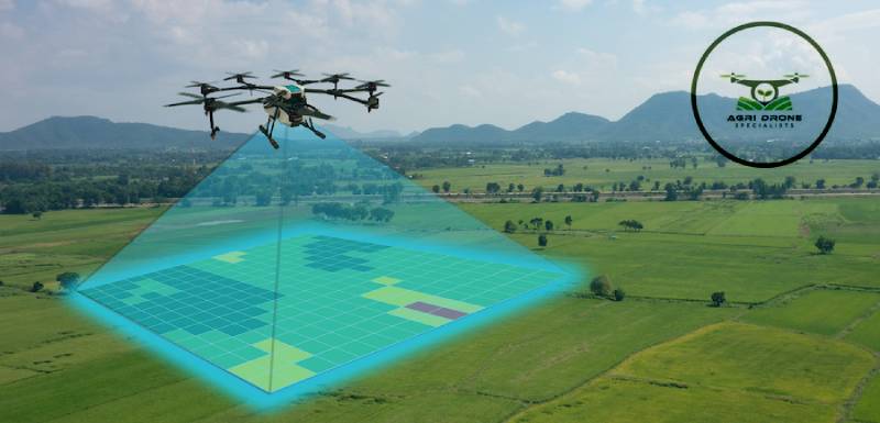
Drone mapping services leverage cutting-edge imaging technology to capture detailed, high-resolution images of agricultural fields. By analyzing these images, variations in crop health can be identified, signaling the potential presence of pests or diseases. Equipped with multispectral and thermal cameras, drones can capture data beyond the visible spectrum, identifying subtle changes in plant health that are invisible to the human eye.
For example, multispectral imaging can detect alterations in how plants reflect light, which can be an early indicator of stress due to pests or diseases. Meanwhile, thermal imaging can reveal temperature variations across a field, pinpointing areas where plants might be compromised by infection or infestation.
Early Detection and Targeted Interventions
The early detection capabilities provided by drone mapping services allow for timely interventions that can prevent widespread damage to crops. Once drones identify areas of concern, farmers can target these specific spots rather than treating an entire field. This precision reduces the need for extensive pesticide and herbicide applications, saving costs and minimizing environmental impact.
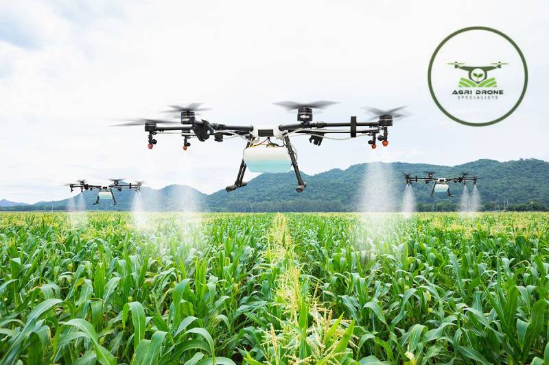
Additionally, drones can be equipped to apply herbicides precisely where needed. After identifying the affected areas, drones can be deployed to deliver treatments directly to the problem zones. This targeted approach ensures that healthy plants are not unnecessarily exposed to chemicals, fostering more sustainable farming practices.
Case Studies and Practical Applications
Numerous case studies illustrate the efficacy of drone mapping services in early pest and disease detection. For instance, in vineyards, drones have successfully identified grapevine diseases before visible symptoms emerge. By analyzing multispectral images, vineyard managers can pinpoint diseased vines and take action to prevent further spread.
Similarly, in extensive cornfields, drones equipped with thermal cameras have detected early signs of pest infestations. This data enabled farmers to apply treatments precisely and promptly, eradicating pests before they could inflict significant damage.
Beyond Detection: Additional Benefits
The benefits of drone mapping services extend beyond the early detection of pests and diseases. The data collected can be utilized to monitor crop growth, evaluate treatment efficacy, and enhance overall farm management. By integrating this technology with existing agricultural practices, farmers can make informed decisions that boost productivity and sustainability.
Conclusion
Drone mapping services are revolutionizing agricultural pest and disease management. The ability to detect issues early and intervene with precision not only protects crops but also supports more efficient and sustainable farming practices. As these technologies continue to advance, they will play an increasingly vital role in modern agriculture, helping farmers worldwide maintain healthy crops and achieve better yields.